
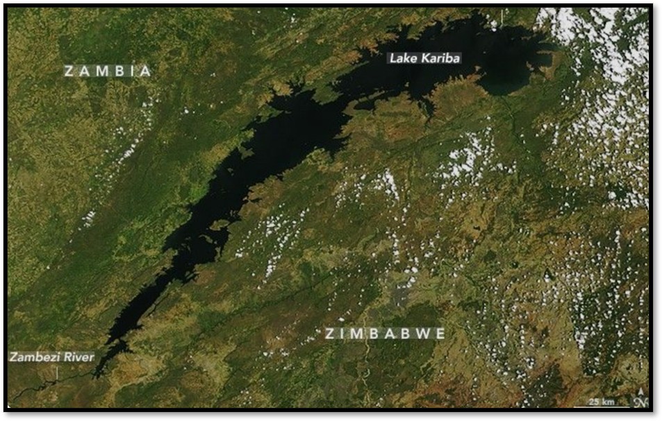
The creation of Lake Kariba, the world's largest man-made lake, triggered significant earthquake activity as it filled with water.
The Cause: Over a three-year period, a local three seismograph monitoring network recorded about 2,000 tremors: successfully locating the epicentres for 159 of them of significant earthquake activity. Researchers traced the epicentres of these earthshakes to the middle Zambezi rift valley, a down-faulted region with a complex tectonic history dating back to the late Precambrian era. They discovered that the immense weight of the new lake during the three-year filling period becoming the world’s largest artificial lake, reactivated ancient fault lines that had been dormant for millions of years.
The Study: Scientists tracked tremor patterns and energy release for nearly 9.4 years. They calculated how underground stress shifted across nine different water levels to measure the total underground area placed under intense pressure.[1]
The Result: The study found a direct link between the water levels and the earthquakes. As the lake filled and the high-pressure zone expanded underground, seismic activity increased right alongside it. The data indicates that the rising water weight reactivated these ancient, existing fault lines.
Lake Kariba is one of the most commonly quoted examples of human activity triggering seismic events. This is called Reservoir-induced seismicity (RIS)[2] Kariba is the world's largest man-made reservoir by volume, containing roughly 185 billion cubic metres (185 cubic kilometres) of water at full capacity, its immense weight drastically altered the stress on the underlying earth's crust when the lake filled in the late 1950’s and early 1960’s.
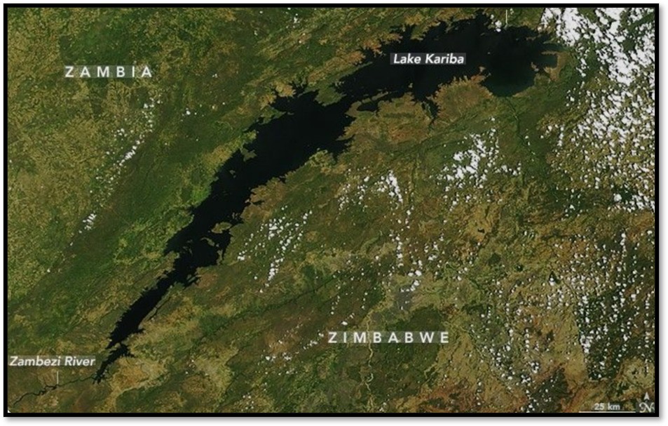
Credit NASA Science: satellite image of Lake Kariba
The Underlying Mechanism
The phenomenon at Lake Kariba occurs due to a combination of two geological factors:
(1) The Elastic Weight Load: the immense mass of the water (roughly 185 billion metric tonnes) exerts direct vertical pressure and caused the earth’s crust to bend and settle when the lake filled between 1958 - 1963. This massive load created immense hydrostatic pressure, re-activating existing fault lines within the Great African Rift Valley system where the Zambezi Valley sits.
(2) Pore Pressure Changes: As water filled the reservoir, it seeped into deeper fractured rock and pre-existing faults. This increased pore fluid pressure acting as a lubricant that reduces friction along fault lines and allows them to slip. Probably this factor played a major role by triggering pre-stressed, low-strength faults and the increased water fluid pressure played only a minor role.
Earthquakes were triggered in two different ways over time:
· Phase 1 (1958 to 1966): The sheer weight of the added water increased the physical stress on existing underground faults, triggering a major earthquake in September 1963.
· Phase 2 (1966–1974): Three years later, this weight-based connection probably stopped. Instead, earthquakes were triggered because water soaked deep into rock fractures, increasing underground fluid pressure and causing the faults to slip.
Using physics models, the scientists proved that both types of triggers are entirely possible along these types of faults. Finally, they noted that within the larger African Rift system, the only two flooded sections of the Rift system - Lake Kariba and the Okavango Delta - are also its two main earthquake hotspots.[3]
Geological Context
Lake Kariba is susceptible to seismic events because it is situated in a naturally active Rift Valley environment at the southern end of the East African Rift System. The region is characterised by a normal-faulting regime. When the massive vertical weight of the reservoir was added to this pre-existing tectonic stress field, it easily pushed active faults past their breaking points.
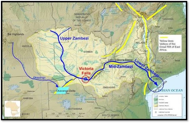
Image credit Gondwana talks: the yellow lines mark the Rift Valley
History of seismic activity
Prior to Lake Kariba’s construction there was very little in the way of seismic activity and earthquakes. However, as the dam filled seismic activity became much more frequent.
The peak of this initial seismic surge occurred in September 1963 with a magnitude 6.3 earthquake as the lake neared full capacity, the largest seismic event due directly to Lake Kariba.[4] Ever since, the lake has triggered more than two thousand seismic tremors of which one thousand have exceeded magnitude 4.0, with more than twenty of these exceeding magnitude 5.0 on the Richter scale.
Ongoing Tremors
More recently these events have continued, for example, a cluster of earthquakes occurred in December 2024, ranging from magnitudes 4.1 to 4.9.[5] Smaller tremors between magnitudes 4.0 and 4.6 continue to be recorded regularly near Binga and in the Hurungwe District.[6] These tremors are generally of low to moderate magnitude and have not been known to affect the dam’s structural integrity. However, they can still cause alarm among local residents.
Archer and Allen’s article ‘A Catalogue of Earthquakes in the Lake Kariba Area, 1959–1968’ is important because it captures and details Kariba tremors of magnitudes ≥ 2.0 spanning from June 1959 to December 1968.[7]
Gradual Decline in tremors
Following the completion of the Kariba Dam wall, the sluice gates were closed on 2 December 1958 and the waters of the Zambezi River then rose rapidly over the next five years until the massive reservoir finally filled to its maximum level. Before this time , the Middle Zambezi Rift valley was considered as largely non-seismic. Clearly the number of seismic tremors was highly correlated with rising water levels after Lake Kariba reached its maximum capacity in July / August 1963. However, tremor frequency has gradually declined after mid-1966 as the faults locked up and the stress field changed.
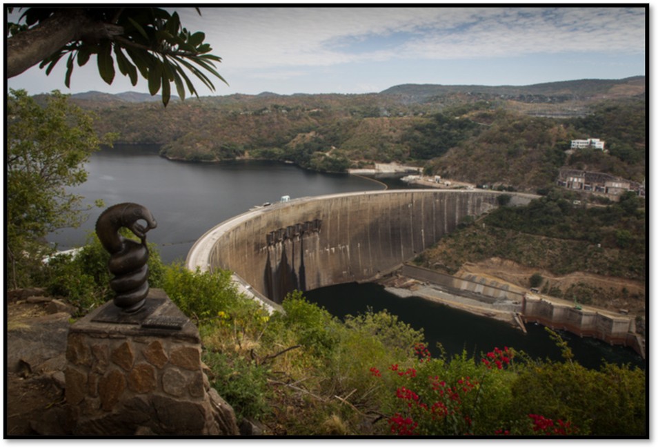
The river God Nyami Nyami overlooking Lake Kariba wall
Structural Safety Impacts
Despite the frequency of these Reservoir-induced seismicity’s the Zambezi River Authority (ZRA) consistently monitors the structural integrity of Kariba Dam. Most tremors are deep or minor enough that they are barely perceptible to humans and pose no threat to the dam wall or surrounding populations. Comprehensive instrument diagnostics verify that the dam remains structurally safe against these regular adjustments of the Earth's crust.
However, as a precaution, the Kariba Dam is inspected after each event by the Zimbabwe River Authority (ZRA)[8] and the instruments records are analysed for any anomalous behaviour irrespective of the magnitude. The ground accelerations and vibrations generated by these localized reservoir-induced seismic events have been far too weak to cause any damage to the concrete.[9]
Separate Structural Challenges: While the seismic tremors are harmless to the wall, engineers have addressed other non-seismic concerns - such as the erosion of the downstream plunge pool - through ongoing international rehabilitation projects.
Data Limitations: Due to a minimal, underfunded local monitoring network of only three seismographs, only 159 epicentres have been precisely mapped out of the thousands recorded.
Tremors have shown a steady decline after mid-1966 as the faults have begun to lock back into place and the stress field dissipated. Based on the provided text, the main activity near and under the deep Sanyati Basin culminated during the last week of September 1963, which was exactly five weeks after the lake reached its maximum level. During this single week, five of the seven large shocks (events with magnitudes between 5.0 and 5.8) occurred alongside many hundreds of aftershocks. This peak followed a steady build-up of seismic activity that began earlier that year in June.
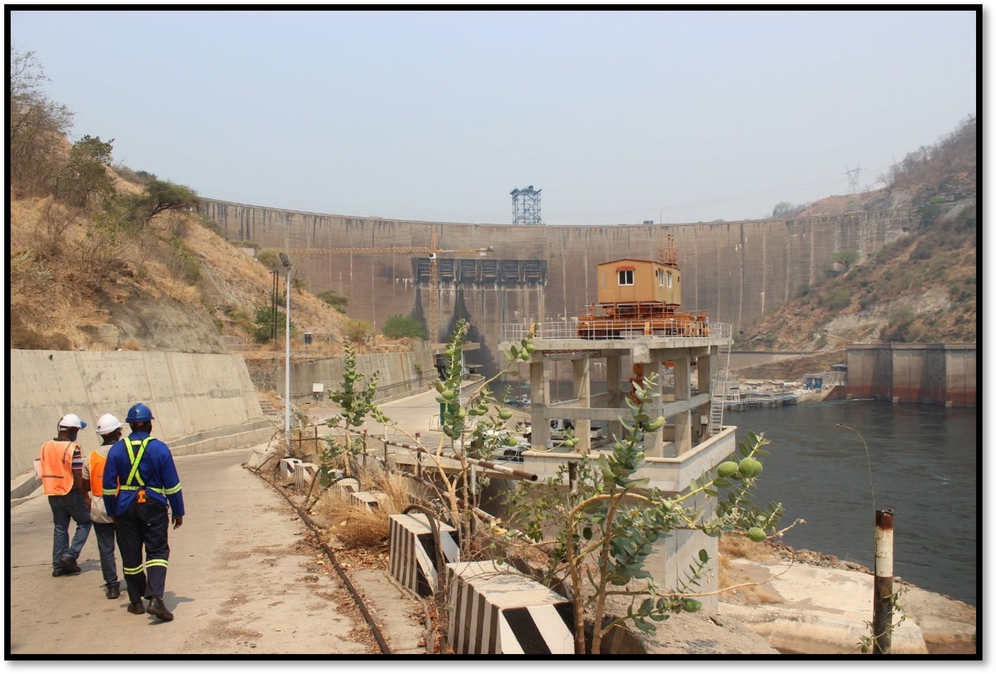
Work being carried out on the downstream plunge pool at Lake Kariba
ZRA bulletin of 4th August 2022[10]
An earthquake of magnitude 4.3 occurred and was felt in the Kariba and surrounding areas at 10.03 pm on 2 August 2022. The epicentre was triangulated by the Meteorological Services Department (MSD) of Zimbabwe to approximately 50km South of Kariba Dam near Bumi Hills. Although this is a naturally active seismic area, it started experiencing increased seismicity after the filling of Lake Kariba in the 1960’s. Accordingly, the earthquakes are normal and expected. They are referred to as “reservoir induced tremors” because they are attributed to the presence of the lake.
In the last twelve months, two earthquakes of equivalent magnitudes and several others of smaller magnitudes occurred south of the Kariba Dam. Of note are magnitude 4.5 and 4.6 earthquakes that occurred on 9 August 2021 and 24 May 2022, with epicentres near Binga and below the Lake respectively.
We wish to assure the public and those domiciled in and around the affected areas that tremors of this magnitude are not expected to affect the structural integrity of the Kariba Dam. We further confirm that there were no unusual observations made from the inspections that were carried out on the morning of 3rd August 2022 nor from the analysis of dam safety data that is collected from several instruments that monitor the behaviour of the dam.
References
D.I. Gough and W.I. Gough. Load-induced Earthquakes at Lake Kariba—II. Geophysical Journal International, Volume 21, Issue 1, October 1970, Pages 79–101, DOI:10.1111/j.1365-246X.1970.tb01768.x
D.I. Gough, W.I. GoughTime dependence and trigger mechanisms for the Kariba (Rhodesia) earthquakes. Engineering Geology. Date: December 1976. Pages: 211-217. Volume 10, Issues 2–4
https://www.sciencedirect.com/science/article/abs/pii/0013795276900211
C. B. Archer & J. N. Allen. A Catalogue of Earthquakes in the Lake Kariba Area, 1959–1968. Meteorological Services, Salisbury, 1969
Notes
[1] A Catalogue of Earthquakes in the Lake Kariba Area, 1959–1968
[2] Load-induced Earthquakes at Lake Kariba—II. Data from Archer and Allen's catalogue was heavily utilized by international researchers (such as D.I. Gough and W.I. Gough) to mathematically model how mechanical loading and water table diffusion alter geological strain to trigger earth tremors.
[3] A Catalogue of Earthquakes in the Lake Kariba Area, 1959–1968.
[4] This remains the largest earthquake ever recorded in Zimbabwe. A cluster of five major shocks (magnitudes 5.0 to 5.8) occurred at this time
[5] https://news.pindula.co.zw/2024/12/23/early-morning-earthquake-rattles-kariba/
[6] ZRA https://www.zambezira.org/media-centre/press-release/earth-tremor-experienced-kariba-dam
[7] A Catalogue of Earthquakes in the Lake Kariba Area, 1959–1968
[8] The Zambezi River Authority (ZRA) is a bi-national organization mandated to contribute to the economic, industrial, and social development of the Republics of Zambia and Zimbabwe by obtaining the greatest possible benefits from the natural advantages offered by the waters of the Zambezi River (between Zambia and Zimbabwe) through the most economical and effective means of providing water for generation of electricity and for other purposes which the Contracting States may decide upon.
[9] The ZRA measures safety based on ground vibration and acceleration rather than the Richter magnitude alone. Even when moderate quakes occur nearby, the energy reaching the wall does not exceed design safety limits
[10] ZRA https://www.zambezira.org/media-centre/press-release/earth-tremor-experienced-kariba-dam