The Great Zimbabwe Hill Complex in photographs - 2025
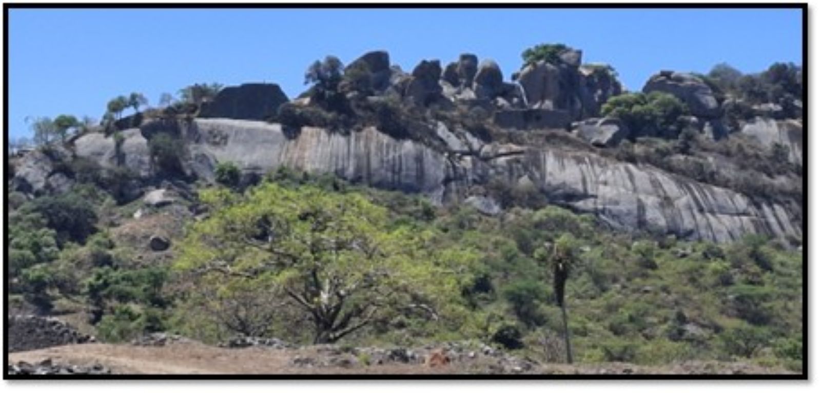
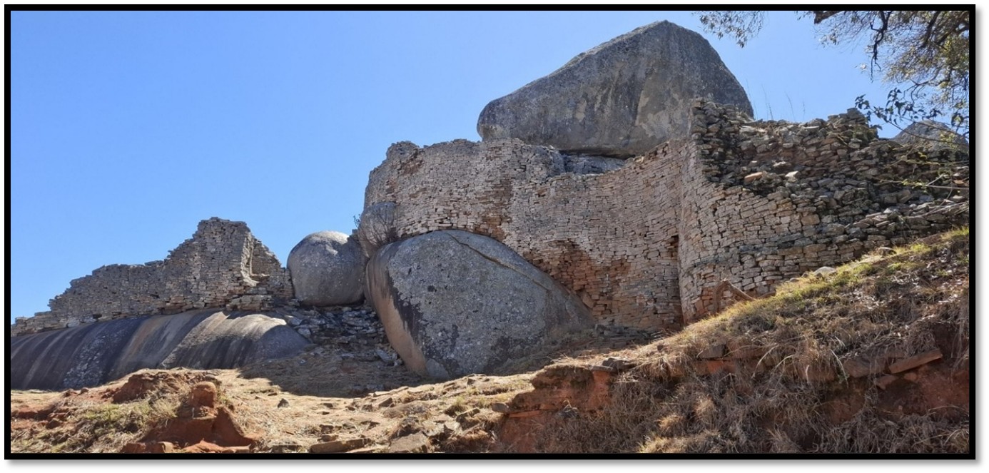
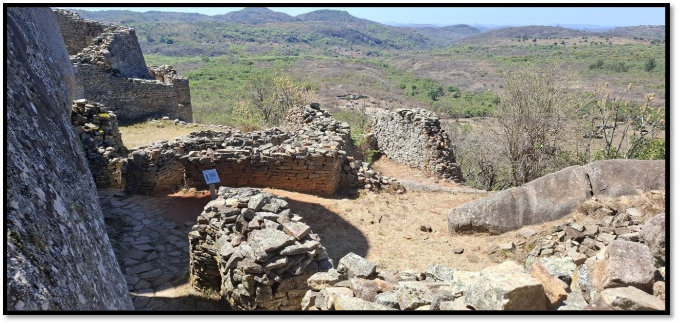
The Hill Complex from the valley
The Great Zimbabwe site is dominated in the north by a narrow ridge of granite, 300 feet (90 metres) high and topped by a jumbled mass of massive boulders that fall away on the south side as a sheer cliff. Amongst the boulders and along the cliff edge are a series of small walled enclosures in the earliest style of walling separated by narrow twisting passages.
The Hill Complex shows signs of occupation by Early Iron Age people in the 4th Century. However the earliest walling at the lowest part of the south wall of the Western Enclosure dates from about the 11th Century with the vast majority of the Great West Wall being built several centuries later.
Occupation may not have been continuous from the 4th Century, but from the 10th – 11th Centuries occupation on the Hill Complex was continuous until the very end of the 19th Century. Almost a thousand years of continuous occupation makes the Hill Complex very unusual in African culture as most settlements are much shorter due to the loss of fertility in the land and gradual shortage of firewood for cooking and heating. As Roger Summers writes this confirms the importance of the site as the inhabitants could clearly get food from beyond the immediate area of Great Zimbabwe.
Although the Hill Complex looks like a fortress it was clearly ascendable and was probably invaded in the 1830’s by the Nguni or Ngoni people under Zwangendaba who migrated north of the Limpopo River into what is now Zimbabwe, where tradition has them attacking the Rozwi people who inhabited the plateau between the Limpopo and Zambezi rivers. Later it was raided by the amaNdebele who were primarily after cattle, women and young men, but did not settle.
Karl Mauch describes the inhabitants as ‘Balosse’ but probably meant Rozwi.[1] After them tribal conflict brought other changes but in 1890 when the Pioneer Column arrived Great Zimbabwe was held by Duma under sub-chief Mugabe who had previously paid tribute to the Rozwi. In 1892 when Sir John Willoughby started his amateur excavations there was still disputes between the local tribes as to who ‘owned’ the site.
Peter Garlake says that the commonest imported ceramics at Great Zimbabwe was Chinese celadon, a stoneware with various shades of green glaze and were found in later occupation levels and were made during the Ming Dynasty (1368 – 1644 AD) But none of the late Ming blue and white porcelain, common in the 15th – 16th Centuries was found at Great Zimbabwe. At the Portuguese settlements on the coast and at their inland trading posts (Feira’s) from the 16th Century the blue and white porcelain was commonly found, but no celadon: he therefore concludes that Great Zimbabwe probably ceased to have any economic importance after the mid-15th Century.[2]
Occupation of the Great Zimbabwe site ended in 1897 following the Mashona Rebellion or First Chimurenga of 1896-7 when Chief Mugabe and his people were removed by the British South Africa Company although they took no part in the uprising.
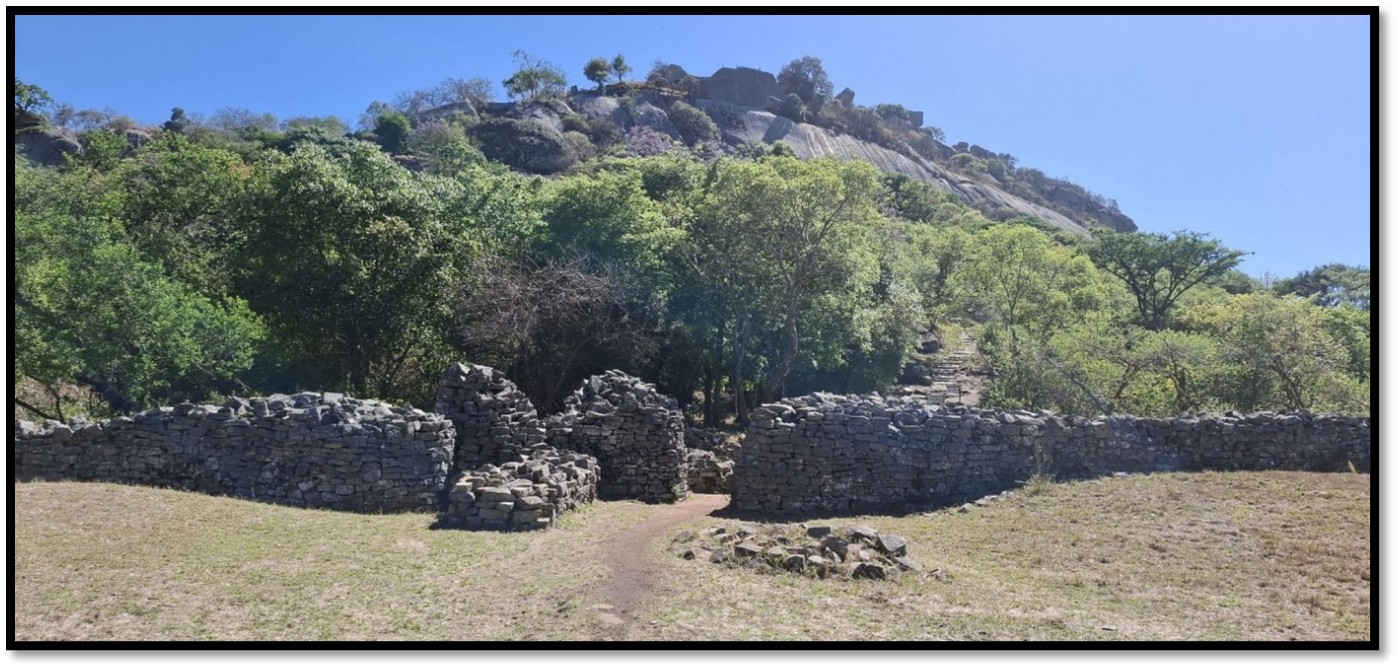
Hill Complex from the outer perimeter wall
There are four approaches up the Hill Complex: the Watergate Ascent, the Modern Ascent, the Terraced Ascent and the Ancient Ascent and they all lead to the foot of the Great West Wall that fronts the Western Enclosure.
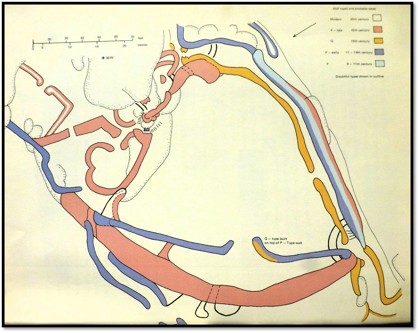
R. Summers: Plan of the Western Enclosure on the Hill Complex with age of walling. Blue = 8-11th Century, Grey = 11th-14th Century, orange = 15th Century, red = 16th Century
Construction of the dry-stone walls
The building stones were gathered from the rounded domes of granite that surround the Great Zimbabwe complex. “Thin, parallel-sided slabs of granite, 7 – 18 cms (3 – 7 inches) thick split off the domes [exfoliate due to the changes between the hot days and cool nights] much as an onion peels and slide down the slopes to collect as scree at the bottom. There they can readily be cracked and broken down into manageable sizes for carrying away, so providing an abundant and handy source of building material”[3]
“These blocks therefore, were not only an extremely accessible material, they also lent themselves to building techniques based on more or less regular horizontal layers of stone. The Walls of Great Zimbabwe were built in exactly this way. Blocks were laid without any mortar to make walls from 1.2 – 5.2 metres (4 to 17 feet) thick whose height was about double their thickness. This method of construction produced inherently sound walls whose wide bases exerted an even and relatively small pressure on the ground, flexible enough to adjust to any subsidence that occurred, yet sufficiently wide in relation to their height to ensure their stability and whose slabs were not easily dislodged.”[4]
“The fit and flushness of the faces was frequently improved by in situ knapping of the corners and exposed surfaces of the blocks with a fist-sized, spherical dolerite hammer-stone, a finer-grained and less easily fractured rock than granite.”[5]
“All walls seem to have been built up to their full height at one point first and then extended horizontally. This obviated any necessity for scaffolding in even the highest wall, for the working face of the wall would form a ramp up which labourers could climb. It also enabled the layout or curvature of the walls to be adjusted as work preceded.”[6]
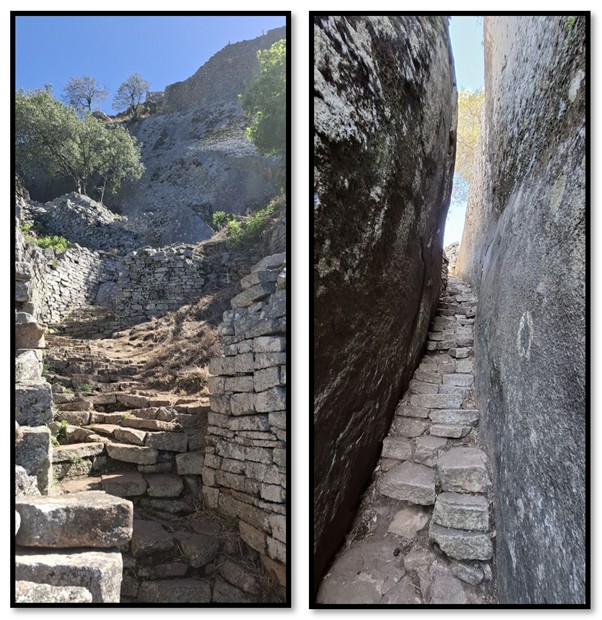
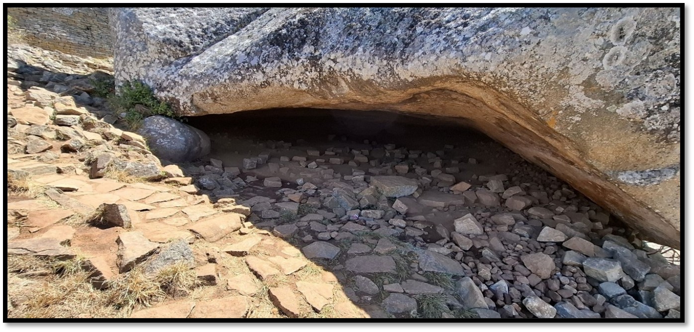
The Terrace Ascent The Ancient Ascent
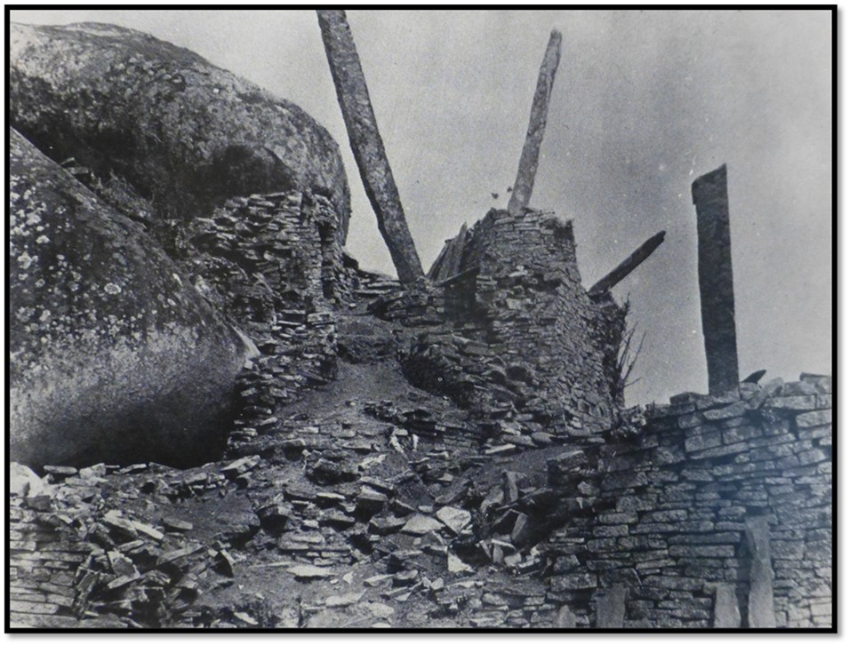
Summers writes that much of the original ‘ancient’ ascent was swept away when a section of the South Wall of the Western Enclosure collapsed when the foundation failed. The remaining 20 metre portion that rises through the narrow cleft shown in the photo above is probably original.[7]
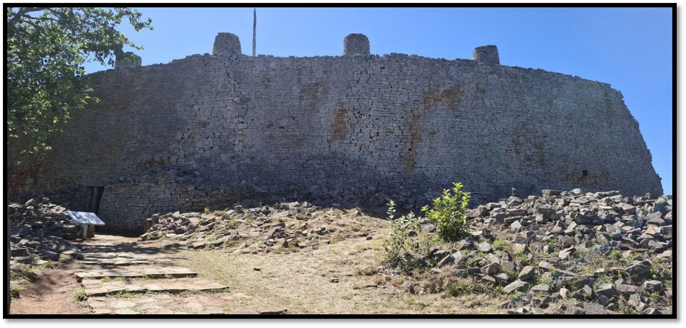
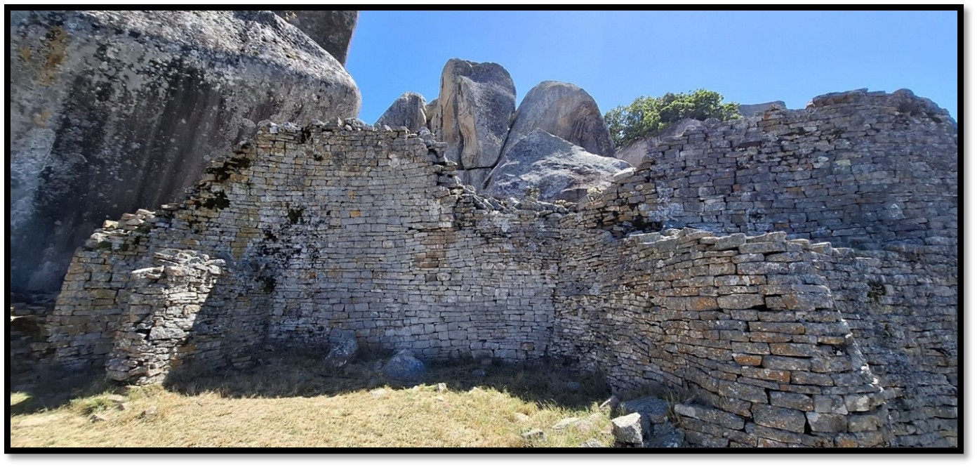
The Great West Wall enclosing the Western Enclosure dating from the 12th-13th Century
The walls of the Great West Wall are nearly 8 metres high and 4.2 metres wide at their widest. It was very broken in 1890 and much of the wall was rebuilt in the time of curator A. St. C. Wallace between 1911 – 1948 with most of the rebuilt sections marked with metal labels. Summers says the current entrance was not visible in R.N. Hall’s time as curator from 1902 – 4 and Wallace may only have found it whilst clearing falling stone. The entrance was cleared and rebuilt as the present tunnel-like structure. Another original entrance (now blocked) was at the southern end of the West Wall.
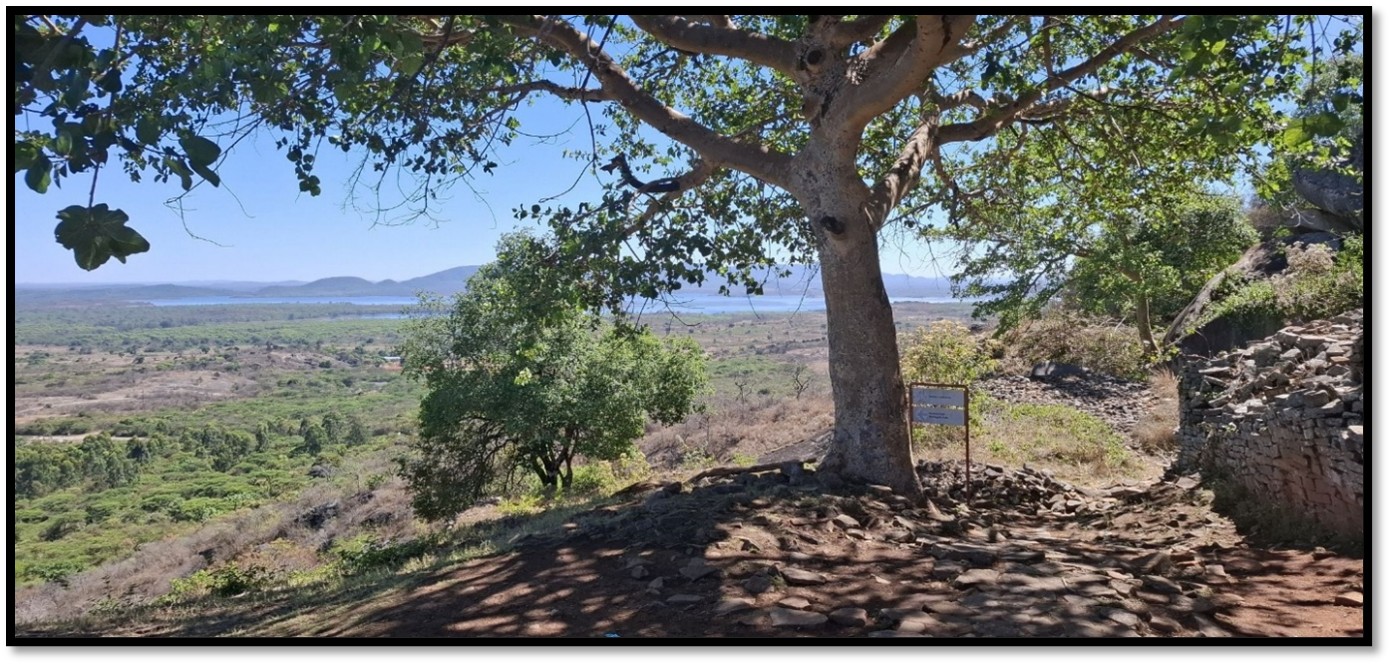
View north from outside the Western Enclosure towards Lake Mutirikwi (formerly Lake Kyle)
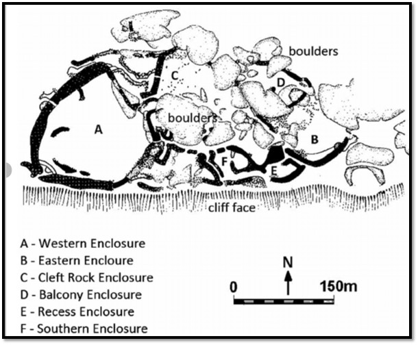
Plan of the Hill Complex from I. Pikirayi: Stone architecture and the development of power in the Zimbabwe tradition AD 1270 – 1830. Photos below are referenced to this plan.
This iconic view of the interior of the Western Enclosure (A) features in many publications
Another angled photo of the interior of the Western Enclosure (A) viewed looking east
The western enclosure “is bounded by two curved walls over 30 feet (9 metres) high, the most substantial erection on the hill or in the earlier walling style., capped by turrets and monoliths. The interior of this enclosure originally had an uneven rock floor but before the building of the wall started this was levelled off with dhaka brought up from the pits around the base of the hill. As dhaka structures were built, decayed and were demolished to allow for renewed building, this enclosure filled up with deposits that finally reached a depth of 14 feet (4.3 metres) It is five times the size of any other enclosure on the hill and had room for about fourteen dhaka dwelling huts.”[8]
For many years, the Western Enclosure was a jumble with red dhaka heaps lying around, piles of loose stones and ruined walls. In 1915 much clearing of this area took place with a good deal of dhaka being thrown over the cliff. The deposits were the result of generations of pole and dhaka thatched huts that had been built one on top of the other. K.R. Robinson, author of Khami Ruins, in 1958 counted eleven different hut floors with the huts densely packed together, often just a metre apart.
Summers believes that early Type 3 buildings including the Western Enclosure contained solid dhaka walls rather than poles surrounded by dhaka. He theorises that the roof timbers did not rest directly on the dhaka walls but on upright beams set outside the dhaka walls that carried the weight of the roof and also provided a verandah.[9]

Interior of the Western Enclosure (A) looking towards the Great West Wall. Mabel Bent[10] photographed seven turrets on the top of the West Wall, although there are only four turrets at present.
NAZ: Hall’s excavations in the Western Enclosure (A); note the monoliths on the left
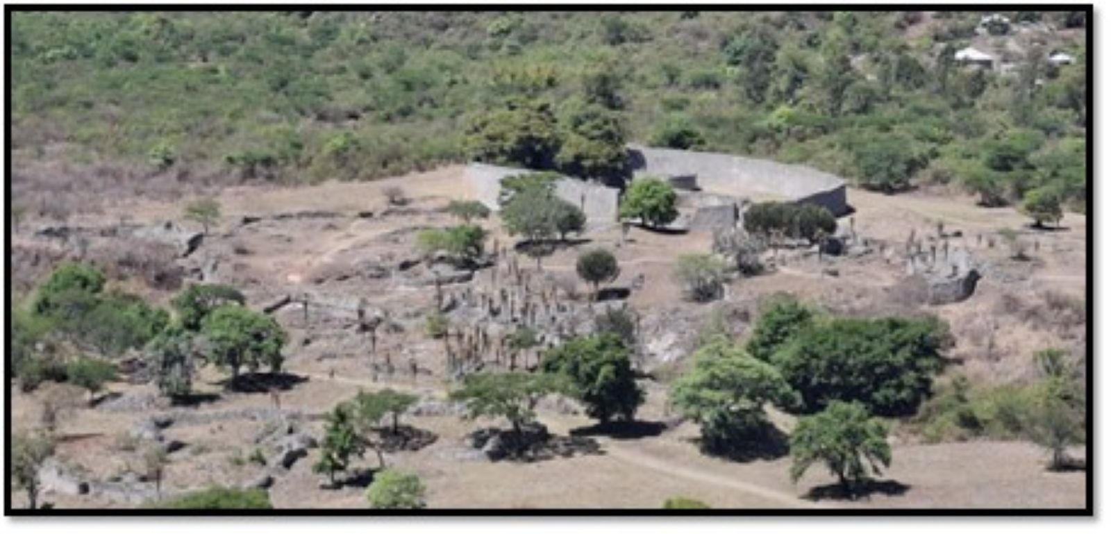
View from the Hill Complex to the Great Enclosure and Valley Complex
This view of the Great Enclosure taken through the gap in the wall where the south wall of the Western Enclosure has collapsed. In 1958 the cause of the collapse was revealed – there is a narrow but deep cleft in the rock that was filled with stones and debris but as the south wall was built the insecure foundation gave way under the weight of stone spreading debris over the lower part of the Hill Complex and the Ancient Ascent. However it does provide archaeologists with a ready-made cross-section demonstrating how walls were constructed!

Doorway with stone supports on the eastern side of the Westen Enclosure (A)
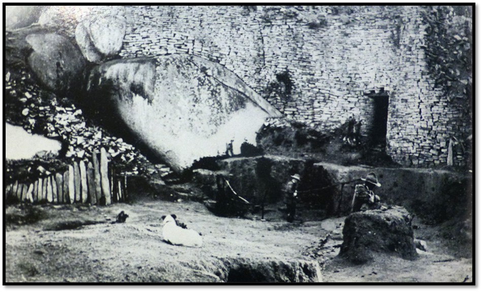
This original covered stairway leads from the Western Enclosure with stairs and a twist in it and is a remarkable example of the builder’s skill. Summers says it is the only original covered stairway at Great Zimbabwe.[11] It used to lead up to a platform with monoliths but was been walled off as dangerous. Theodore Bent saw three monoliths[12] on this platform and another monolith close by with geometric patterns that he removed and gave to the South African Museum in Cape Town.[13]
NAZ: 1902 Photo by R.N. Hall in 1902 of the platform and monoliths described above
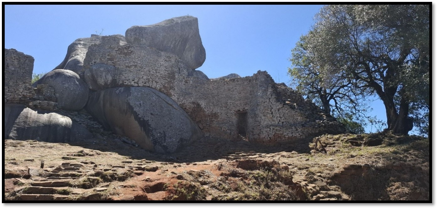
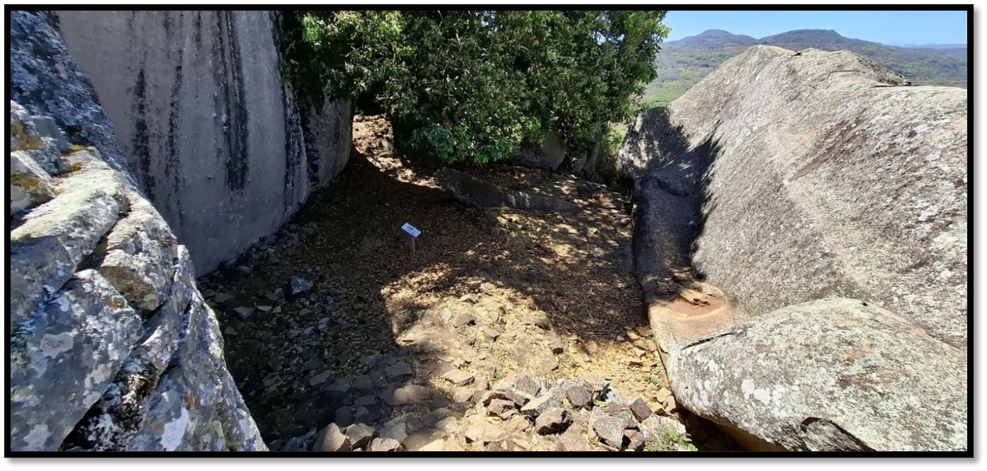
View into the Southern Enclosure (F)

The Southern Enclosure (F) looking outwards
The Southern Enclosure (F) looking inwards

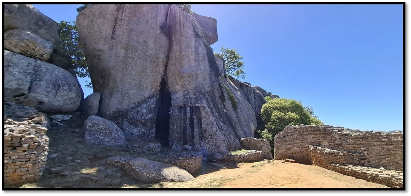
The Recess Enclosure (E) is quite often overlooked by visitors and so-called because of the four slots built within the walls that may have held wooden posts supporting a thatched roof with archaeologists theorising it might have been a gathering area or small shrine

At the eastern end of the Hill Complex is the Eastern Enclosure. Garlick writes that the south wall was once capped by a dentelle patterned frieze. Inside the enclosure the ground slopes steeply upwards and in 1890 was strewn with a jumble of fallen stone blocks. The area was probably originally terraced to support groups of circular stone platforms each holding some of the considerable number of monoliths that were found in this enclosure including some of those with the soapstone birds. A narrow passage leads from the eastern enclosure up between rocks to the flat top of a large boulder that was surrounded by three walls to form the highest enclosure on the hill, ‘the balcony’ overlooking the eastern enclosure and the valley below.[14]
The outer wall and courtyard of the Eastern Enclosure (B) that may have been the place where the spirit mediums connected with their God Mwari and the ancestors. Clearly a sacred area as several soapstone Zimbabwe bird sculptures were discovered here reinforcing the belief this area had ritual and religious significance.
A passage leads from the Western Enclosure through a range of small enclosures to finally arrive at the Eastern Enclosure, sometimes called the ‘Eastern Temple.’ In 1889 four carved soapstone birds were found here although Karl Mauch who came here in 1879 does not describe them, so perhaps they were hidden away at the time or elsewhere.[15]
However Summers writes that the soapstone birds although found in various parts of Great Zimbabwe are all, except for one, originally from the Eastern Enclosure of the Hill Complex.[16]
Another view of the Eastern Enclosure (B) showing how it is dominated by the huge granite boulders
The Balcony Enclosure (D) where gold smelting furnaces and quartz rock were excavated confirming the presence of metal-working at the Hill complex. Finished gold beads and broken crucibles were also found confirming gold was worked in this area for trade or ornaments.
The small cave above the Recess (E) / Southern Enclosure (F) that may have been used by the spirit mediums or an oracle to communicate with the ancestors and has the remarkable acoustic property of transmitting words spoken in a normal voice that can be heard 600 metres away in the Great Enclosure provided there is no wind. S.D. Sandes, curator from 1948 – 59 was told about this phenomena by his African staff in 1950 and tested it several times. Undoubtably this acoustic effect played a spiritual part in the siting of Great Zimbabwe.[17]
References
P.S. Garlake. Great Zimbabwe. Thames and Hudson, London 1973
I. Pikirayi. June 2013. Stone architecture and the development of power in the Zimbabwe tradition AD 1270 – 1830. Azania Archaeological Research in Africa 48(2):282-300. DOI:10.1080/0067270X.2013.789225
R. Summers. Ancient Ruins and Vanished Civilizations of Southern Africa. T.V. Bulpin, Cape Town 1971
Notes
[1] See the article Karl Mauch, explorer and geologist and the man who claimed to be the first European to visit Great Zimbabwe under Masvingo Province on the website www.zimfieldguide.com
[2] Great Zimbabwe, P109-110
[3] Ibid, P15
[4] Ibid, P16
[5] Ibid, P17
[6] Ibid, P17
[7] Ancient Ruins and Vanished Civilizations of Southern Africa, P142
[8] Great Zimbabwe, P26
[9] Ancient Ruins and Vanished Civilizations of Southern Africa, P125
[10] See the article The Bent’s archaeological expedition to Great Zimbabwe in 1891 and the prominent part played by Mabel Bent under Masvingo on the website www.zimfieldguide.com
[11] Ancient Ruins and Vanished Civilizations of Southern Africa, P7
[12] The three monoliths were photographed in situ in 1914 but disappeared subsequently and have not been located
[13] The five soapstone birds held by the South African Museum were returned in 1981 in exchange for a collection of insects and are now displayed at the Great Zimbabwe Museum.
[14] Great Zimbabwe, P26-7
[15] See the article Karl Mauch, explorer and geologist and the man who claimed to be the first European to visit Great Zimbabwe under Masvingo on the website www.zimfieldguide.com
[16] Ancient Ruins and Vanished Civilizations of Southern Africa, P164
[17] Ibid, P7